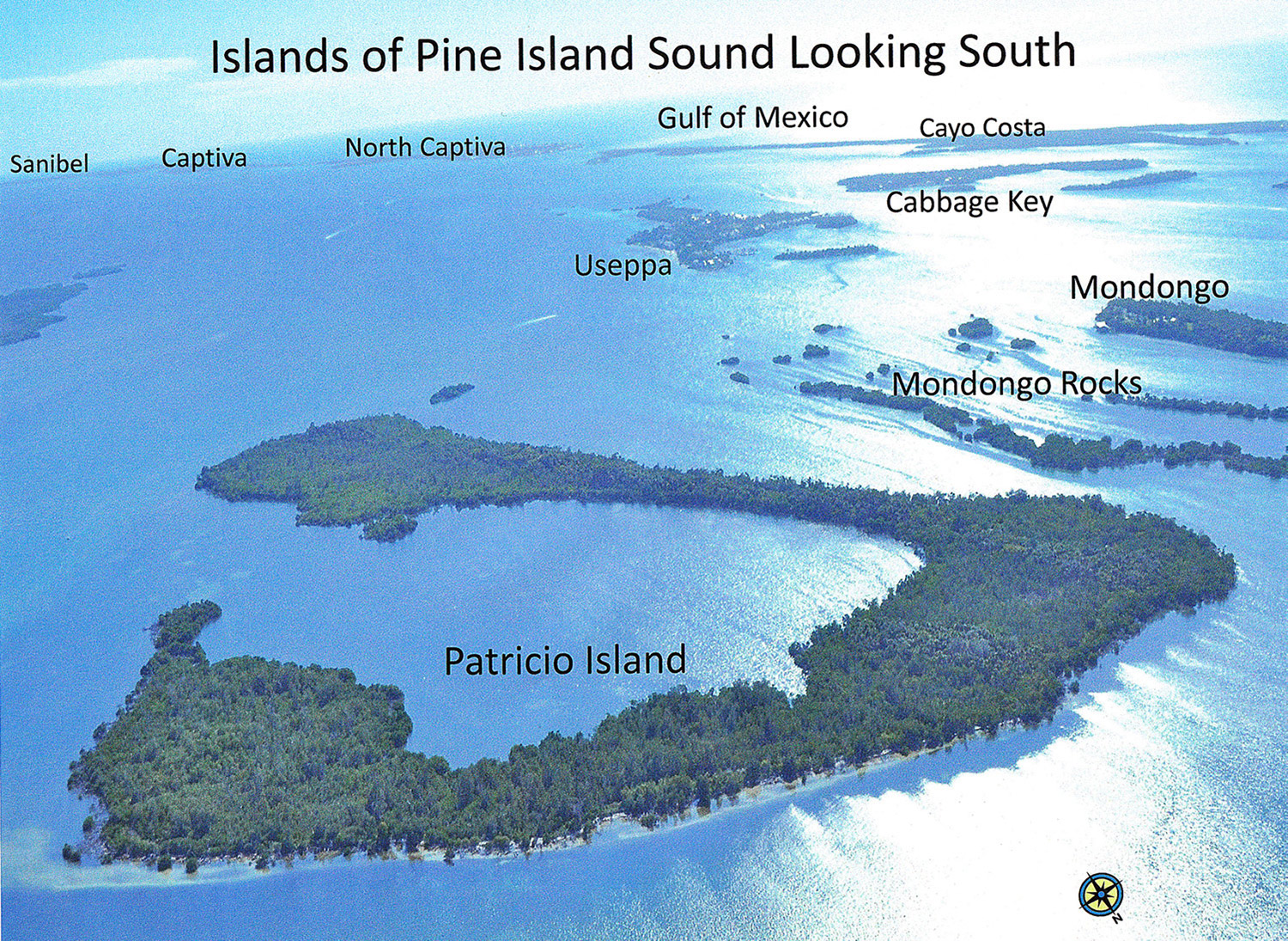
Patricio Island is a vegetated sand dune surrounding a central lagoon. Located at the northern end of Pine Island Sound, its north side faces Charlotte Harbor. Its eastern side parallels a naturally deep channel that appears on a 1774 navigational chart drawn by the English explorer Bernard Romans.
Patricio is distinguished within the Pine Island National Wildlife Refuge as being one of three uninhabited islands in the refuge with enough elevation to support upland habitat. It was not always unoccupied. Shallow shell middens exist on the higher portions. No systematic archaeological surveys have been conducted, but according to archaeologist John Worth, “They probably have Caloosahatchee-period occupation (500 BC – 1750 AD) and possibly earlier Archaic deposits. The Spanish name Patricio hints at the existence of a Cuban fishing rancho (1750-1835).” After 1911, Barron Collier established orchards and gardens on Patricio Island to feed his hotel guests on nearby Useppa Island. The 1935 census of Patricio lists the Nelson family: a farmer, a housewife, and their two grown daughters, a stenographer and a beautician. Local residents who grew up in the 1940s and 1950s speak of how their parents warned them not to set foot on Patricio because of numerous rattlesnakes.
Mondongo Island is one-fourth the size of Patricio, and is privately owned. The eastern portion has a main house, a caretaker’s cottage, work sheds, and visitor cottages. Surrounded on three sides by shoals, the island lies within the Pine Island National Wildlife Refuge. In 1884 Dr. M. H. Simons, U.S.N., wrote for the Smithsonian Institution: “Mondongo Key, about two (nautical) miles southeast of Boca Grande, is covered to a depth of six to eight feet for half a mile in length and 100 yards in width; below the shells there is probably an equal depth of sand and clay; on its northeastern end there is a conical mound about ten feet in height which commands an extensive view.” An earlier map based on survey data of 1859 shows one structure on what was labeled “Gondonga” Island.

Mondongo has a sand-dune core with shell midden deposits on portions of its surface. No archaeological exploration has been done, although a Cuban fishing rancho was likely there. Boats enter from the south by a single deep channel. Commercial and recreational fishermen state that the fishing in that channel is exceptional just after a high tide. East of the channel lies the treacherously shallow and beautiful Mondongo Rocks, an extensive, visually spectacular panorama of oyster bars and sand bars colonized by red mangroves. These formations take on an otherworldly appearance when rising from the mist.
In 1899 a renewed survey of the islands of Pine Island Sound attracted the attention of Albert W. Gilchrist. Trained in surveying at West Point, he is credited for conducting accurate surveys of Sanibel, Captiva, parts of Pine Island, and the smaller islands of Pine Island Sound. During his earlier military career he had served as a brigadier general of the Florida Militia and a captain in the U.S. Army during the Spanish-American War. By 1899 he was serving the first of two terms in the Florida House of Representatives, when he purchased Mondongo Island for $175. He sold it in 1901 for $1001. In 1909 he was elected the twentieth governor of Florida.
The 1937 owner of Mondongo Island, Murray Coggalshall, grew avocadoes and assisted Dr. Charles Breder with tarpon studies on Cabbage Key. Mrs. Coggalshall provided Christmas parties and gifts for the children who attended school on Punta Blanca Island, according to Kirk Walter in Boat Goat . From 1961 to the present, Mondongo Island has been owned by members of the same family, descendants of the late Chester Howell Ferguson, former Chairman of the Board of Directors and Chief Executive Officer of Lykes Brothers, Inc., which at that time was a major force in cattle shipping, meat packing, citrus, banking, utilities, electronics, and steel.
The origin of Mondongo’s cryptic name offers a fascinating line of inquiry. In the Spanish language, mondongo is a stew of tripe or fish intestines, a spicy delicacy. Alternatively, “ Mondongo is a common name found in the African groups imported into Cuba, the Caribbean, and Florida in the 18th century,” according to Dr. Jane Landers, Vanderbilt University Professor of History (personal communication, 2014.) Her book entitled Black Society has a list of imported Africans from the 1750s including Mondongos. Mondongo has also been identified as the name of a Bantu language related to languages of the Congo Epena district, according to a study by William L. Gardener.
Africans from the Congo have also been documented living in the same Cuban towns into which the Calusa Indians sought sanctuary from slavers in the 1700s. Regla and Guanabacoa, Cuba provided bases from which persons seeking avenues out of slavery were hired as fishing guides and deckhands by Cuban commercial fishing operators to Pine Island Sound from 1750-1835. As reported by Dr. John Worth in the September, 2006 issue of this news- letter, José María Caldéz, Cuban owner of a fishing rancho on Useppa Island, owned at least two enslaved Africans in 1824 in his hometown of Regla, Cuba. One of them, María de los Dolores Caldéz, was from the Congo. Her son, who was born on Useppa Island, was freed by José Caldéz in 1836 upon the occasion of his baptism in the cathedral at Regla, Cuba. While these specifics do not prove a direct connection to the naming of Mondongo, they provide compelling clues for continuing research.
This article was taken from the Friends of the Randell Research Center Newsletter Vol 13, No. 3. September 2014.