Over 500 species of fish reside in waters off south Florida’s shoreline while over twice as many fish species live in the waters of the Gulf of Mexico and the Florida Current.
The richness in species diversity is due to the mixing of tropical and temperate species throughout this region as well as the varied marine environments including reefs, estuaries, mangroves, seagrass beds, and bays.

The Everglades sheet flow of water eventually drains into the Florida Bay to the south and the Gulf of Mexico to the southwest. In these drainage areas, freshwater and seawater mix, creating brackish water estuaries. Organisms living in estuaries have adaptations to deal with the variations of salinity and temperature as well as tidal fluctuations and local weather patterns. The majority of recreationally and commercially caught fish, crustaceans, and shellfish spend at least part of their lives in these estuaries.
Florida Bay

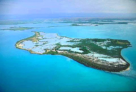
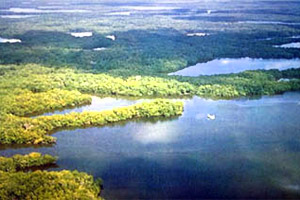
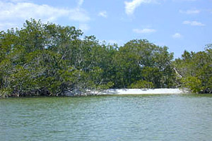
Florida Bay is the largest body of water within the Everglades National Park, covering more than 1,100 square miles (2,850 square km) between the southern tip of Florida and the Florida Keys. Consisting of a series of shallow water basins, the bay is located on a shallow shelf where freshwater flowing from the Everglades mixes with salt water from the Gulf of Mexico. The shoreline along Florida Bay supports mangrove forests with nearshore waters dotted with hundreds of mangrove islands. The bottom of the bay includes extensive seagrass beds and hardbottom reef habitat. Fresh surface water enters the bay via sheet flow and direct flow from Taylor Slough from the southern portion of the Everglades into Whitewater Bay. However, this flow of freshwater has greatly decreased over the past century due to the construction of a series of canals in the Everglades. Freshwater also enters the bay through rainfall, surface run-off, and groundwater. This mixing of saltwater and freshwater results in a salinity gradient across the entire bay, with salinities increasing from the north to the south. In recent years, the waters of Florida Bay have been hypersaline with salinities reaching over 35 parts per thousand (ppt).

Gulf of Mexico
The Gulf of Mexico includes the westernmost coastal waters of the Everglades National Park. The dividing line separating the Gulf of Mexico and Florida Bay runs from Long Key northwest to Cape Sable. Shark River Slough carries freshwater from the western Everglades into the Gulf of Mexico, creating brackish water estuaries along the shore including mangrove swamps and tidal rivers as well as many small mangrove islands in an area referred to as the Ten Thousand Islands.
Glossary terms on page:
Florida Current: the segment of current between the Gulf of Mexico Loop Current and the Gulf Stream form the Dry Tortugas to the southeastern tip of Florida, and confined by the 250 meter and 500 meter isobaths.
diversity: refers to the variety of species within a given association, areas of high diversity are characterized by a great variety of species.
tropical: tropical zone lies between 23.5 degrees north and south of the equator, has small seasonal changes in temperature and large seasonal changes in precipitation.
temperate: temperate zone lies between 30 and 60 degrees latitude, climate undergoes seasonal changes in temperature and moisture.
brackish: somewhat salty, containing salt, where freshwater mixes with saltwater.
salinity: concentration of total salts dissolved in water, usually measured in parts per thousand.
hypersaline: Water with excessive or supersaturated salt content.