Turtle Grass (Thalassia testudinum)
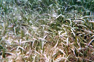
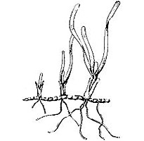
Turtle grass is the most common of seagrasses off the coast of Florida and throughout the Caribbean. It also occurs in Bermuda, and south from the Gulf of Mexico to Venezuela. The grass blades are flat and ribbon-like, growing to 14 inches (35.5 cm) long and ½ inch (10 mm) wide. These blades have 9-15 parallel veins each, and are densely colonized by epiphytes. These long, broad blades distinguish it from other species of seagrasses. There are two to five blades per rhizome node. These rhizomes may be as deep as 10 inches (25 cm) below the substrate surface. Turtle grass typically occurs from the low tide level to depths of approximately 30 feet (10 m) on sand and rubble-covered bottoms. Turtle grass grows in extensive meadows throughout its range. The common name “turtle grass” refers to green sea turtles (Chelonia mydas) that graze on large fields of this seagrass.
Manatee Grass (Syringodium filiforme)
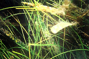
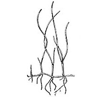
Occurring throughout most of Florida’s estuaries, manatee grass is the second most common seagrass in Florida waters. It is also found in Bermuda, the Bahamas, and throughout the Gulf of Mexico and the Caribbean. Manatee grass, along with turtle grass, is found in tropical coastal waters with salinities of 20-36 parts per thousand (ppt). The blades of this seagrass are cylindrical with two to four blades arising from each rhizome node. These blades can reach lengths of 20 inches (50 cm) in some locations. Roots of this seagrass barely go below the substrate surface. It commonly occurs growing with other species of seagrasses or alone, in small patches. Commonly referred to as manatee grass, it is a favorite food of the manatee.
Shoal Grass (Halodule wrightii)
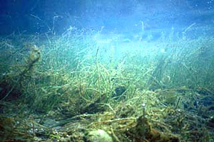
Shoal grass colonizes disturbed areas where conditions are too harsh for turtle and manatee seagrasses to occur. This seagrass ranges from North Carolina, south along the Atlantic and Gulf of Mexico coasts, to the Caribbean. It is also found off of portions of South America, northwestern Africa, Indian Ocean, and the west coast of Mexico. Although shoal grass commonly occurs in estuarine waters with salinities of 10-25 parts per thousand, it also forms dense patches in high salinity areas exposed to wave energy or in tidal flats. The blades are clustered from a single node on the rhizome, with notched blade tips. The flat, narrow blades grow to maximum lengths of 4-6 inches (10-15 cm) and widths of only .08-.11 inches (2-3 mm).
Johnson’s Seagrass (Halophila johnsonii)
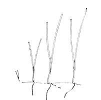
Johnson’s seagrass was first recognized as a separate species in the Indian River Lagoon in 1980. It was named in honor of J. Seward Johnson Sr., the founder of Harbor Branch Oceanographic Institution in Ft. Pierce, Florida. The National Marine Fisheries Service considers the Johnson’s seagrass to be a threatened species under the Endangered Species Act, due to its limited distribution. Its distribution ranges from central Biscayne Bay (north of Virginia Key) to Sebastian Inlet. Johnson’s seagrass has been documented within flood-tidal deltas, muddy basins, sandy shoals, and near canals, tolerating fluctuations of salinity and water clarity. Johnson’s seagrass has paired leaves originating from a single rhizome node. Measuring 0.04-0.12 inches (1-3 mm) wide and 4-8 inches (10-20 cm) in length, the blades are light green with a brown midrib and veins. This seagrass was added to the list of threatened species under the Endangered Species Act on September 14, 1998. As protected by the ESA, the recovery plan for the Johnson’s seagrass is currently being developed. Management plans are now in place for the Indian River Lagoon, Biscayne Bay, and Loxahatchee River Aquatic Preserves.
Paddle Grass (Halophila decipiens)
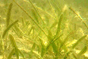
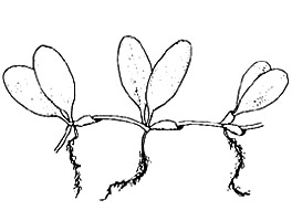
This seagrass occurs on the continental shelf near the Indian River Lagoon, the Gulf of Mexico, the Caribbean and the Indo-West Pacific. The paddle grass resembles Johnson’s seagrass, but is distinguishable by a finely serrated leaf margin and a paddle-shaped green blade terminating with a rounded tip. The two, opposite, blades measure 0.5-1.0 inches (10-25 mm) long and 0.12-0.23 inches (3-6 mm) wide, extending directly from nodes on the rhizome. Rhizomes creep through soft substrates, forming patches of paddle grass in shallow waters.
Star Grass (Halophila engelmanni)
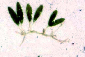
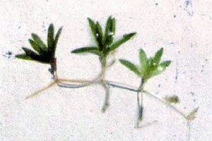
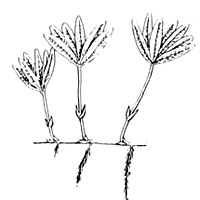
Star grass occurs in Florida, the Bahamas, Texas, and the West Indies, growing on sandy or muddy bottoms at depths to 130 feet (40 m). The 0.5-1.2 inch (10-30 mm) long blades are clustered in groups of 4-8, arranged in a star-like whorl. Each cluster has two scale leaves at the base as well as a second pair halfway up the leaf stem. The smooth, flat blades have distinct midribs and veins and fine-toothed edges.
Widgeon Grass (Ruppia maritima)
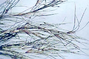
Although widgeon grass is not a true seagrass, it grows in both fresh and brackish aquatic environments. It is widely distributed worldwide in temperate and subtropical regions. In North America, widgeon grass is found along the Atlantic coast from Newfoundland south to Texas. The blades are wider at the base of the stem, arising alternately from the sheath and tapering to long pointed tips. This grass is often confused with shoal grass in low salinity locations. Forming extensive meadows in subtidal areas with exposure to intense sun, widgeon grass is able to tolerate some dessication. Since it does not occur in full-strength seawater, it is not considered a true seagrass. However, the widgeon grass does provide food and refuge for a variety of organisms, similar to the function of the true seagrasses.
Glossary terms on page
- rhizome: the somewhat elongate portion of a plant’s stem that is underground, producing shoots above and roots below.
- substrate: the material upon or within an organism lives or grows, including soil, plants, animals and rocks.
- tropical: tropical zone lies between 23.5 degrees north and south of the equator, has small seasonal changes in temperature and large seasonal changes in precipitation.
- salinity: concentration of total salts dissolved in water, usually measured in parts per thousand.
- threatened species: plants or animals likely to become endangered in the near future.
- temperate: temperate zone lies between 30 and 60 degrees latitude, climate undergoes seasonal changes in temperature and moisture.
- brackish: somewhat salty, containing salt, where freshwater mixes with saltwater.
- desiccation: removal of moisture, drying out.